

Today’s episode is with the founder of Dekart, Volodymyr Bilonenko.
We cover WHY he made Dekart, the relationship with Kepler, who he competes with and some discussion of specific geospatial needs of mobility companies like Wayve.
He then steps through use of a new Claude skill he made called geoSQL.
This skill uses a map in the loop, yes Claude checks images of its own maps in the course of producing a final Dekart output.
We finish the discussion by looking at how geospatial business models may evolve in the context of Claude native GIS.
It was nice to do another live episode and I appreciated the bravery of Sarah and Roca in asking their own questions. I want to give a shoutout regarding Sarah’s new business, StillPointGeospatial.com. I also really encourage you to test out this new geosql Claude skill. I did so myself. Here is the full prompt:
/geosql Which buildings in North Atlanta (Peachtree Creek, bbox -84.46,33.767,-84.33,33.887) are inside the FEMA 100-year flood zone? Flood zones from Esri Living Atlas USA_Flood_Hazard_Reduced_Set, buildings from Overture on S3. Use local DuckDB only, no warehouse. Color by Floodway / Zone AE / Zone A, add charts. but I don't want all buildings. I only want residential buildings as one layer and another showing any building likely to be used as a kids camp, I want that one turned on by default. I want the camp POIs on as well, if they’re within 250m of a building in a flood zone.
It then helped me to connect to a Dekart trial account and stood processing the prompt for several minutes. The result was a decision to get all Overture Maps Foundation building footprints with a class of ‘cabin’,’dormitory’,’hut’,’bunkhouse’, or ‘static_caravan’. For the particular bounding box specified, no such footprints were returned. It also made a second decision to use the Overture Maps Foundation camp points of interest layer to find any campgrounds or educational camps. Once it had those, it returned any building footprints within 250 meters. It found several, the largest of which was a gym. Note the overall requirement that all records must be in the 100 year flood zone. So yes, it did find something that could ostensibly be used to house children overnight as camp sleeping quarters, with that building being a flood zone.
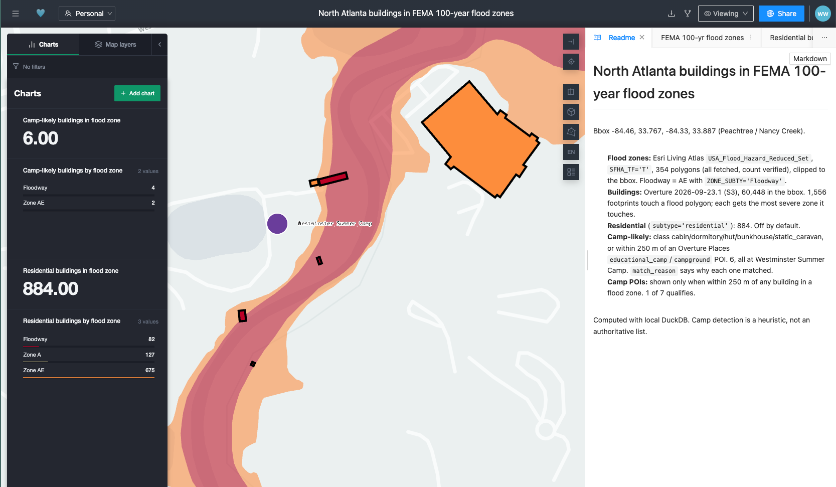
Access: https://cloud.dekart.xyz/reports/117eae0a-6617-4bba-8f05-32da243b5343?
I then prompted a re run but using a bounding box across the whole of Georgia and honestly the results were hard to interpret. What I began to see were hundreds of static_caravan building footprints. I had the feeling that these would rarely serve as sleeping quarters for children’s summer camps. That is where I left it. Nevertheless, it was an incredibly compelling demonstration of what we can now do in Claude native GIS.
To be fair, let’s contrast this with the efficiency of FEMA’s Flood Map Service Center. It promptly loads with a location search box. Putting in just the words Camp Mystic, the site of the tragedy driving this example, immediately shows that it is in a flood zone.
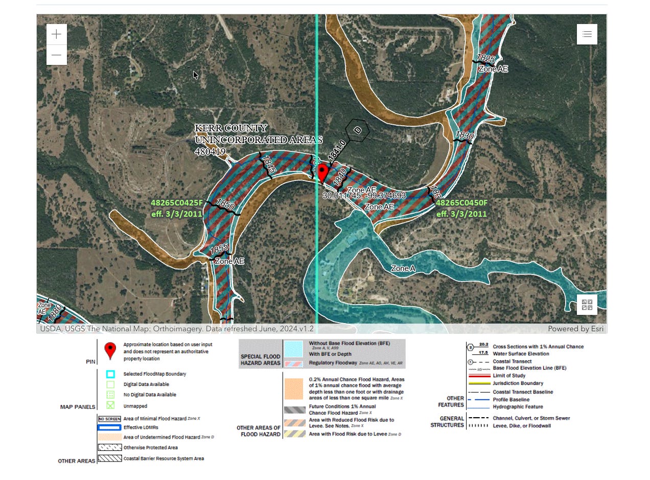
What neither the geoSQL skill output shown in this episode or the FEMA solution do though is give a parent an immediate, plain, yes/no answer on whether a specific location is in a flood zone. On one hand you have to do Claude native GIS. On the other you have to interpret an ugly map legend.
Who is going to build this solution that simplifies the answer?


