CLIPS
Balancing Data, Art, and Audience Needs in Mapmaking
Training Peacekeepers with Virtual Reality and Community Data
Citizen Drone Imagery Accelerates Disaster Mapping
The Vital Role of Local Open Data Communities Worldwide
UN MAPPERS
The podcast is picking up the pace in terms of meeting my heroes. UN Mappers is an open spatial data volunteering programme run by the UN. Michael Montani stepped through the part of the UN he works for and some conflicts or disasters his team is currently helping on. We were also given a look at the UN's operational web map and some commentary on the unique cartographic style that they have to use.
We then discussed what the UN's mapping team cannot do, and the place this creates for a worldwide volunteer effort. To get involved, he instructs us to go to HOT OSM Tasking Manager and search for tasking by the UN Mappers organisation. We were also given details on the comprehensive and multilingual geospatial training offered by the UN to prepare volunteers to make quality contributions. It was a strong show of force regarding what the UN can do to cause a broad benefit for the world in a particular skill area.
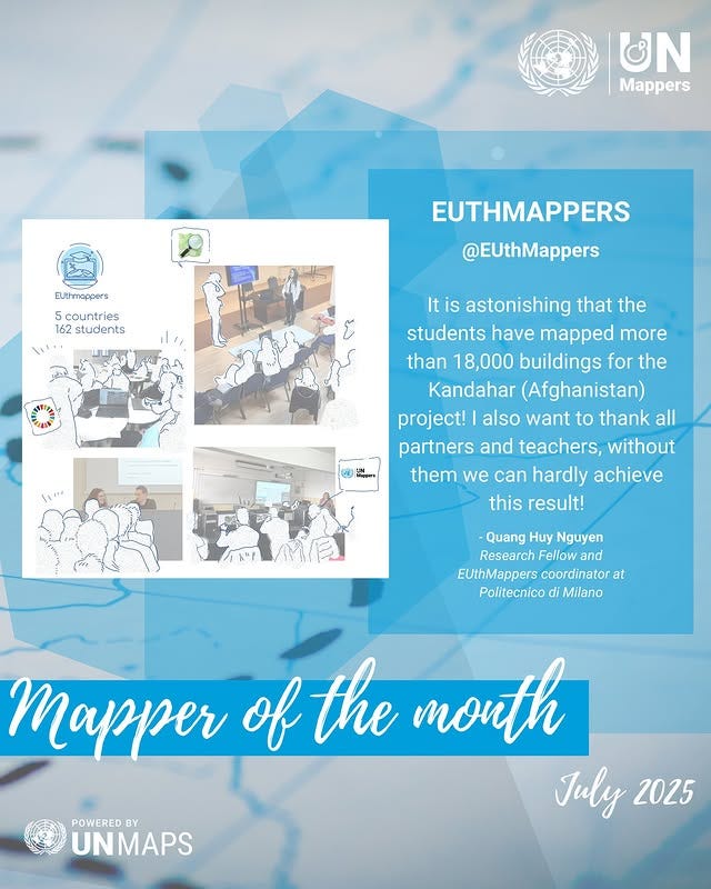
The conversation then turned to how to maintain an enthusiastic, engaged base of contributors. He located volunteered geographic information in the broader realm of citizen science, indicating there is a general set of techniques here to create a rabid corps of contributors. What I appreciated the most is their Mapper of the Month award of the best mapper, called out on Instagram. Here is the latest one:
Of course, I asked about how the UN is approaching the emerging trend of foundation models and AI. Have a listen for his response.
So, what an amazing moment to have had the chance to talk with such a motivated, good natured individual as Michael Montani. Many of us will have wondered what it might be like to work for the UN, surely one of the world's most significant geospatial organisations. In this hour with Michael we have a clear understanding of how they assist in conflicts and disasters, what their operational map looks like and how they go beyond the capacity of their own team by mobilising a volunteer geospatial army.
We are privileged to have had Michael's time.


